This month I thought I would explore the green boundaries of Houghton Regis from east to west with the camera. We start at the Community Orchard on the boundary with Luton by Wheatfield Road.
Along the footpath south of the Woodside Link we find a wonderful display of red and white campion.
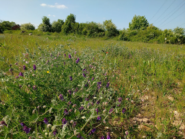
Across the stream is the chalk meadow where tufted vetch is blooming.

The Woodside Link runs across our boundary into Chalton Parish. The road embankments and verges are covered in wildflowers including campion and ox-eye daisies, a wonderful sight for walkers and cyclists.

It appears the cycle paths alongside the Woodside Link are being protected from incursions by banks of soil. I hope these will be grassed over.

Now we go to the western border where Sewell Greenway starts in Totternhoe Parish but moves into Houghton Regis before exiting into Dunstable. I'll do the northern boundary another time.
Just across the border is Totternhoe Nature Reserve where I filmed this corn bunting singing for all its worth.
From the bottom of the Greenway you can look up to the village of Sewell, and the two County Wildlife Sites above it.
From half-way up there are views across the Sewell fields below towards the A505 Leighton Buzzard bypass.
And this is the view east towards Maidenbower at the top of the escarpment.
The hamlet of Sewell is accessible from the Greenway.
A walk along Sewell Lane gives more lovely views.
Back on the Greenway is a helpful Information Board.
At the top of the climb is Maidenbower, site of an ancient hill fort of national significance. This scheduled ancient monument is in Houghton Regis.
Views to the north-west from Maidenbower are long and wide, a beautiful and peaceful spot.
The town boundary is east of Maidenbower running along the edge of Dunstable. It then turns west again alongside Sewell Greenway and at the old Tidy Tip turns north-east running along the crest of the hill, with the two County Wildlife Sites, Barley Brow and Suncote Pits, right on the boundary.

At the A5 the boundary turns south-east along the road then north-east around the edge of the Chalkpit Nature Reserve, another green boundary. In the south-east quarter the boundary touches the corner of Dog Kennel Down then runs through Woodside Estate. The former wooded boundary between Luton and Houghton Regis was sadly cut down and replaced by the Woodside Link. The replacement planting of thousands of trees and hedges has now taken place and hopefully eventually will hide the road. So we return to the Community Orchard where we began.
Thank you for joining me. Next month I look forward to exploring the northern town boundary, much of which is still green and runs along footpaths.


No comments:
Post a Comment